Waterfowl Index Surveys
 The Keweenaw Bay Natural Resources Department (KBNRD) has conducted a waterfowl index during the fall from 1994-present. Sites were chosen on the L'Anse Indian Reservation (Baraga County, MI) and on KBIC owned lands to observe waterfowl utilization: Sand Point Sloughs, Pinery Lakes, Mud Lakes, Head of Keweenaw Bay, and most recently Huron Bay (Click here for map of index locations). Four sites have been improved (wild rice planting, water control structures and/or nesting structures) for waterfowl utilization and one site was removed, Pinery Lakes, due to extremely low water levels and few birds being seen for consecutive years.
This waterfowl index was modeled from a program described by U.S. Fish and Wildlife Service (USFWS) personnel from Ashland, WI. Since 1994, KBNRD has received annual funding from a Bureau of Indian Affairs sponsored cooperative program entitled “Circle of Flight”. Circle of Flight has supported this fall survey and various other activities which benefit area waterfowl and the wetlands they inhabit. A summary of species detected by index site in 2012 is shown below.
|
Species |
Keweenaw Bay |
Huron Bay |
Mud Lakes |
Sand Point |
|
American Coot |
X |
X |
X |
|
|
American Wigeon |
X |
|
X |
|
|
Black Duck |
X |
X |
X |
X |
|
Blue-winged Teal |
X |
|||
|
Bufflehead |
X |
|
|
|
|
Canada Goose |
X |
|
X |
X |
|
Canvasback |
X |
|
|
|
|
Common Merganser |
X |
X |
X |
|
|
Gadwall |
|
X |
|
|
|
Goldeneye |
|
X |
||
|
Greater Scaup |
|
X |
|
|
|
Green-winged Teal |
X |
X |
|
|
|
Hooded Merganser |
|
X |
X |
X |
|
Mallard |
X |
X |
X |
X |
|
Pied-billed Grebe |
X |
X |
X |
|
|
Redhead |
|
X |
|
X |
|
*Richardson Goose |
X |
|
|
|
|
Ring Neck Duck |
|
X |
|
|
|
Scoter |
|
X |
|
|
|
Trumpeter Swan |
X |
X |
|
|
|
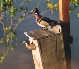
Wood Duck |
X |
X |
X |
X |
*indicates an uncommon sighting for this area
2014 Waterfowl Index and Wild Rice Report
Waterfowl Index Locations